
- Overview
- Trip Outline
- Trip Inclusions
- Trip Exclusions
- Gallery
- Book Now
- FAQ
The Trek
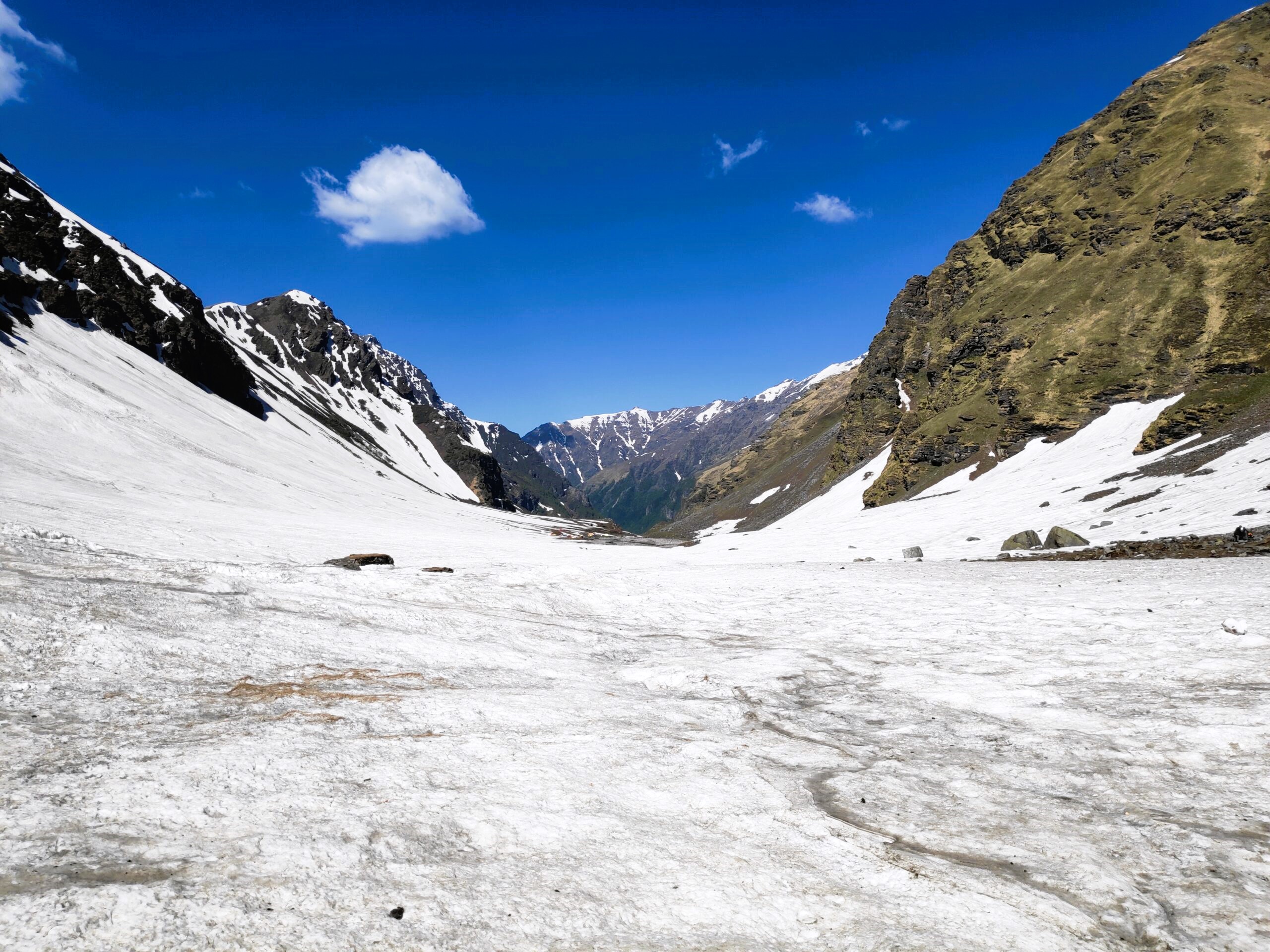
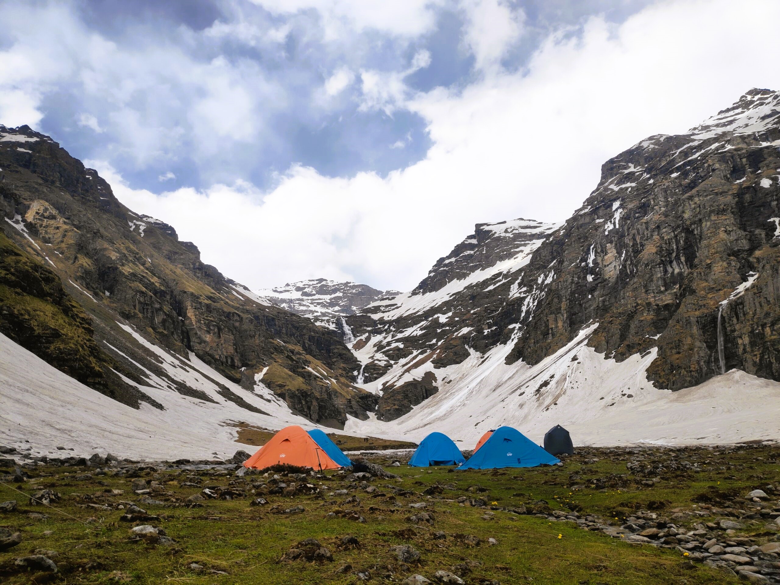
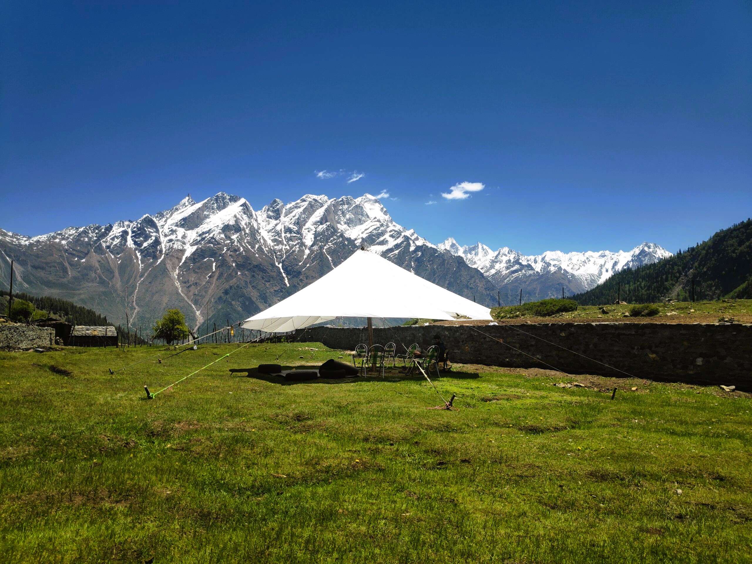
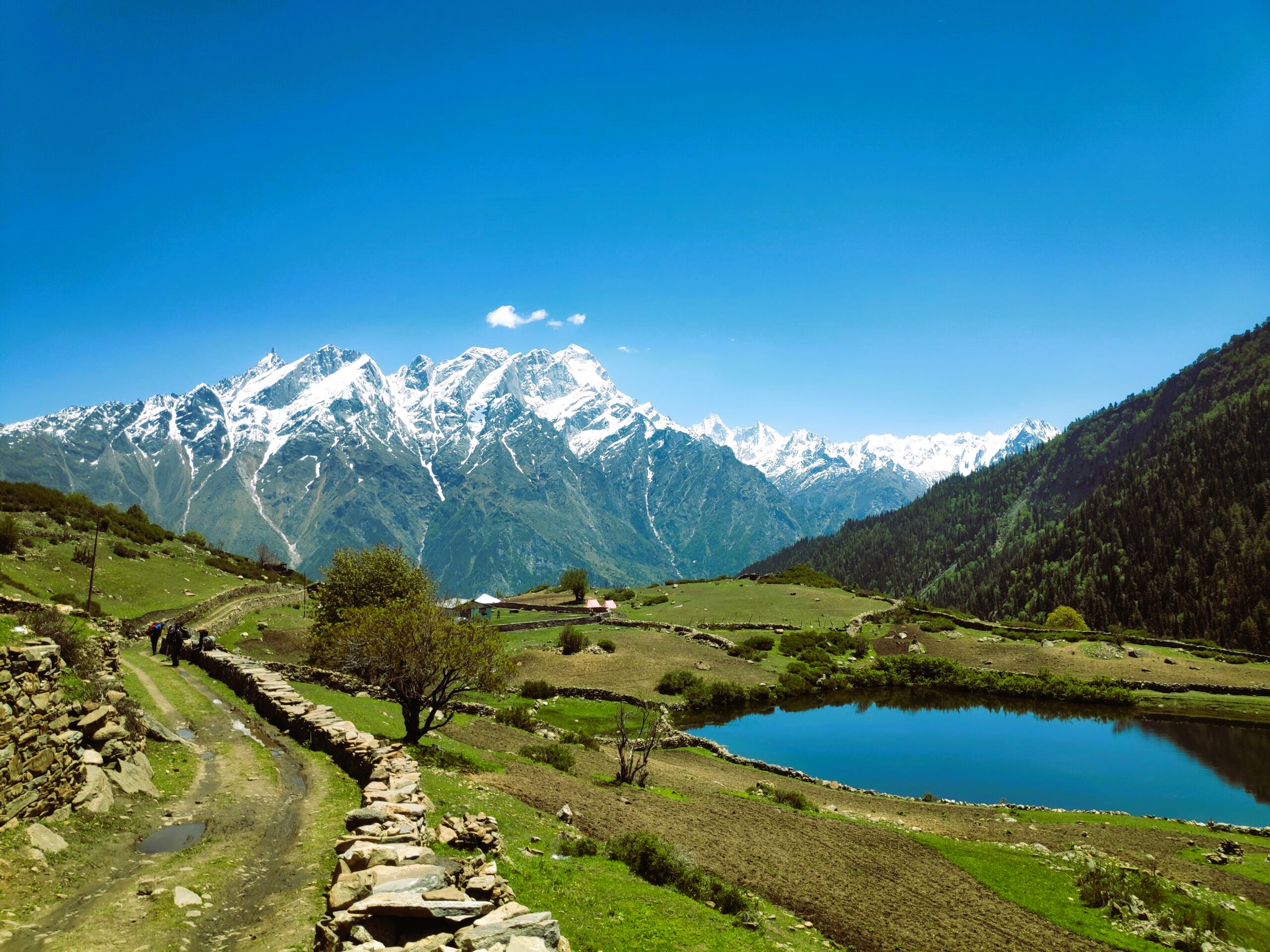
Rupin offers a perfect balance of challenge and beauty. At 15380 ft, Rupin is amongst the top high altitude passes in Himachal. What makes this trek special is that in 8 days, one covers crosses 2 districts and 4 Himalayan villages, and gains almost three times the altitude that one starts from! Rupin also offers spellbinding views, beautiful meadow walks and amazing campsites.
The Area
Rupin is geographically a unique trek. On this trek you are very close to Chainsheel ghati and in Himachal it runs close to the Baspa valley. Both these area are well preserved secrets in their respective.
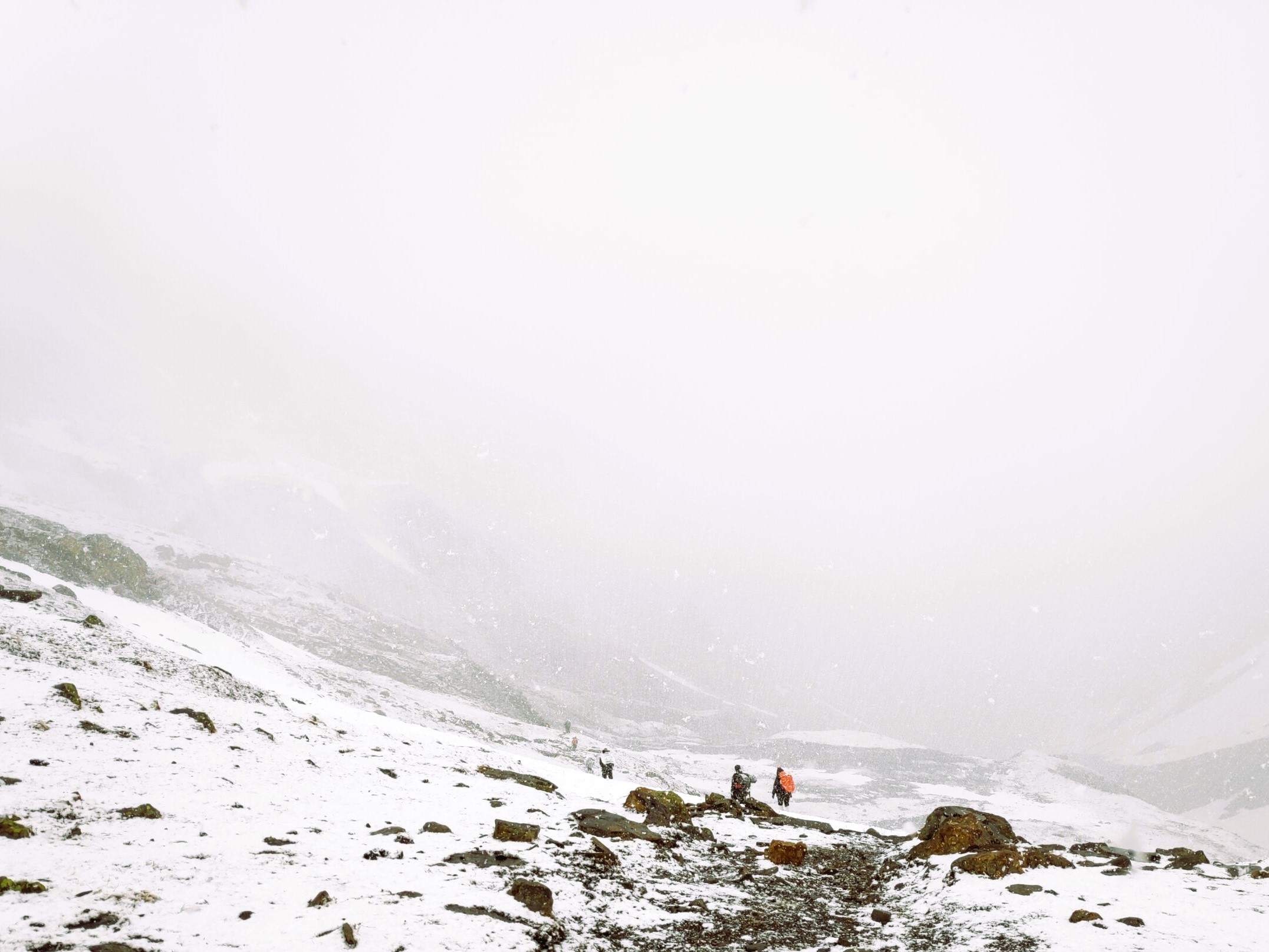
Expected Weather
May-June
- Chances of rain/ hail – Mild to moderate rain can be expected in June. (Though monsoon hits most parts of the country in June, it reaches Uttarakhand properly only after the 15th of June.)
- Snow on trail – Less likely
- Temperatures: Afternoon upto 25 degrees (First two afternoons can get hot sometimes), Nights around 0 degrees (June) at higher camps
Sept-Oct
- Chances of rain/hail – Mild to moderate rain can be expected in September.
- Snow on trail – Possible snowfall in October
- Temperatures: Afternoon upto 20 degrees and Nights around -10 to -12 degrees (Oct) at higher camps
Day 1 - Assemble in Shimla at 7 am. Drive from Shimla to Jiskun (190 Kms)
Overnight stay in homestay. Drive time - 9 hours
Day 2 - Trek from Jiskun (2300 mts) to Jhaka (2742 mts)
Trek Time - 3 hours ; Trek Distance - 4 Kms
Day 3 - Jhaka to Buransh Kandi (3200 mts)
Trek Time - 6 hours Trek Distance - 8 Kms
Day 4 - Buransh Kandi (3200 mts)to Dhanderas Thatch (3564 mts)
Trek Time-3 hours ; Trek Distance - 4 Kms
Day 5 - Acclimatization Day
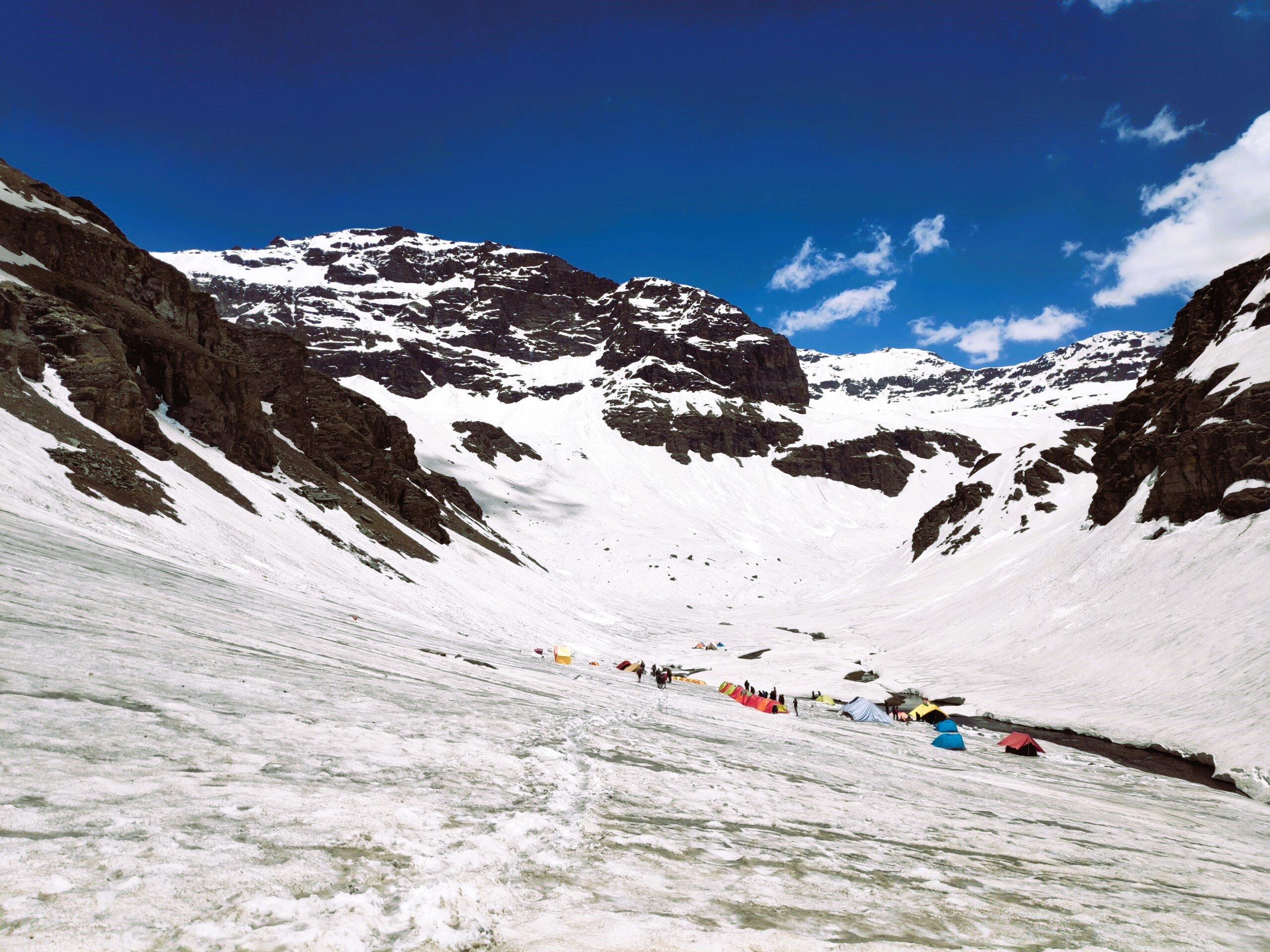
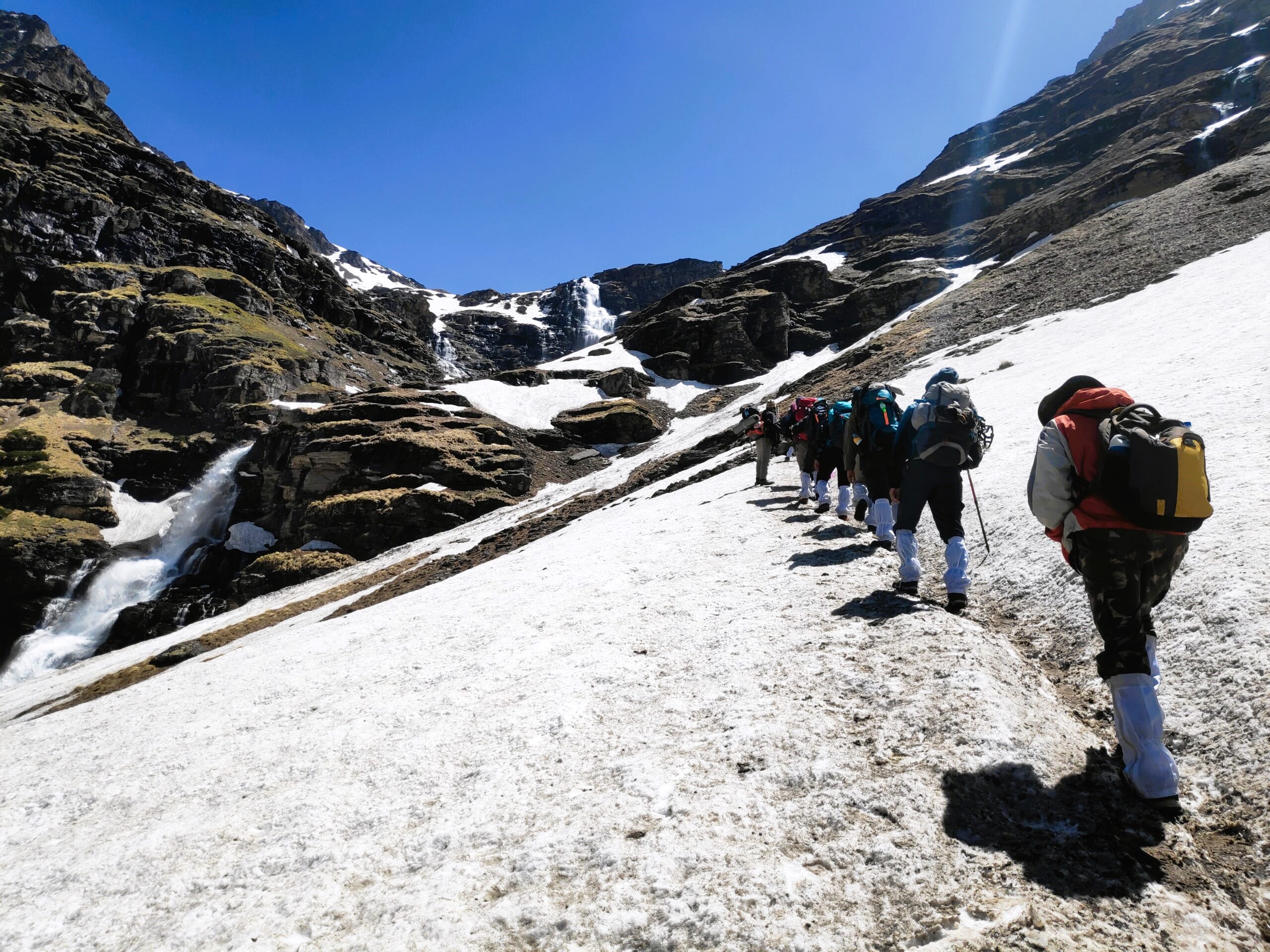
Day 6 - Dhanderas thatch (3564 mts) to Upper Waterfall camp (3991 mts)
Trek Time - 3 hours ; Trek Distance - 2.5 Kms
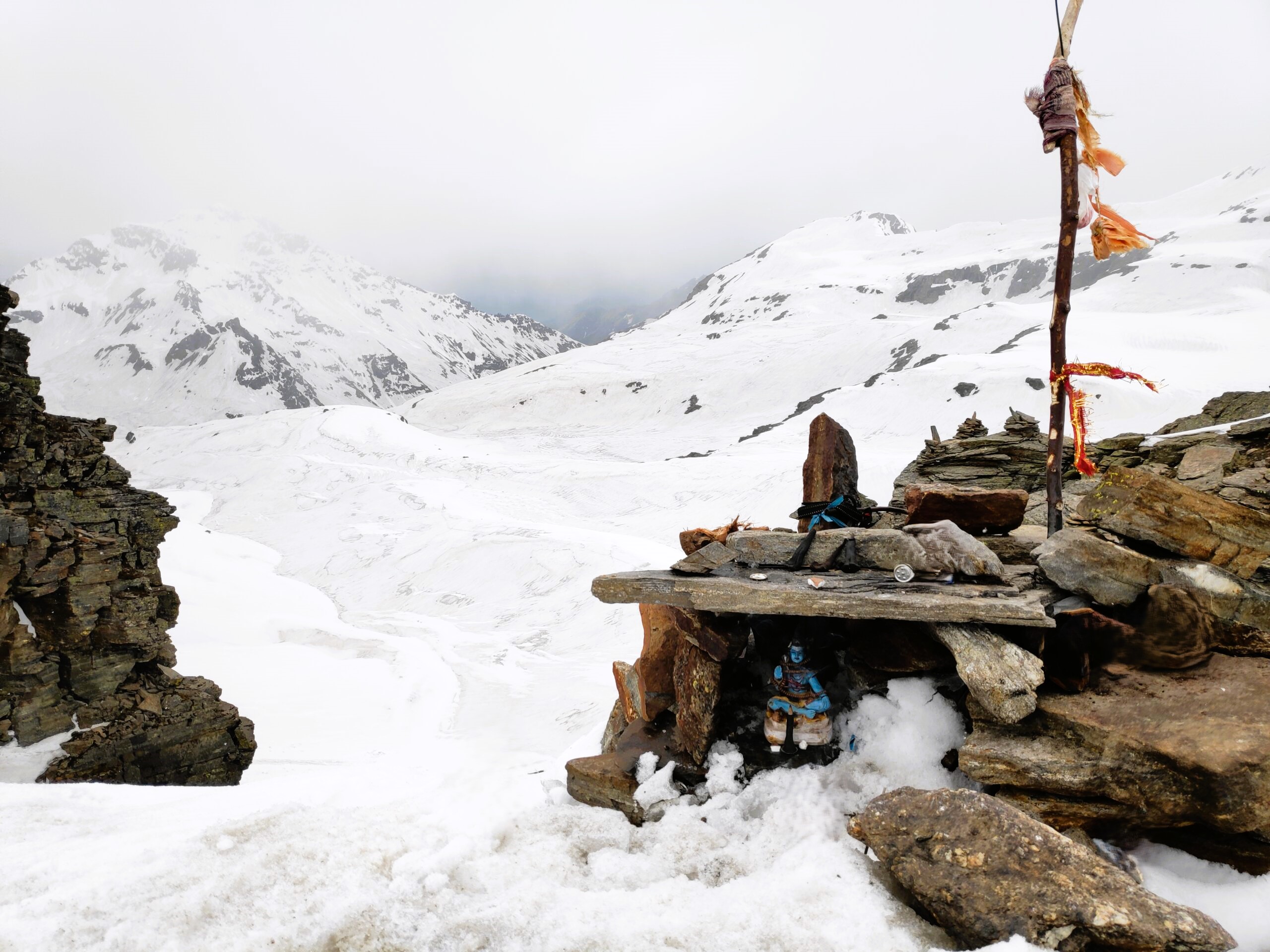
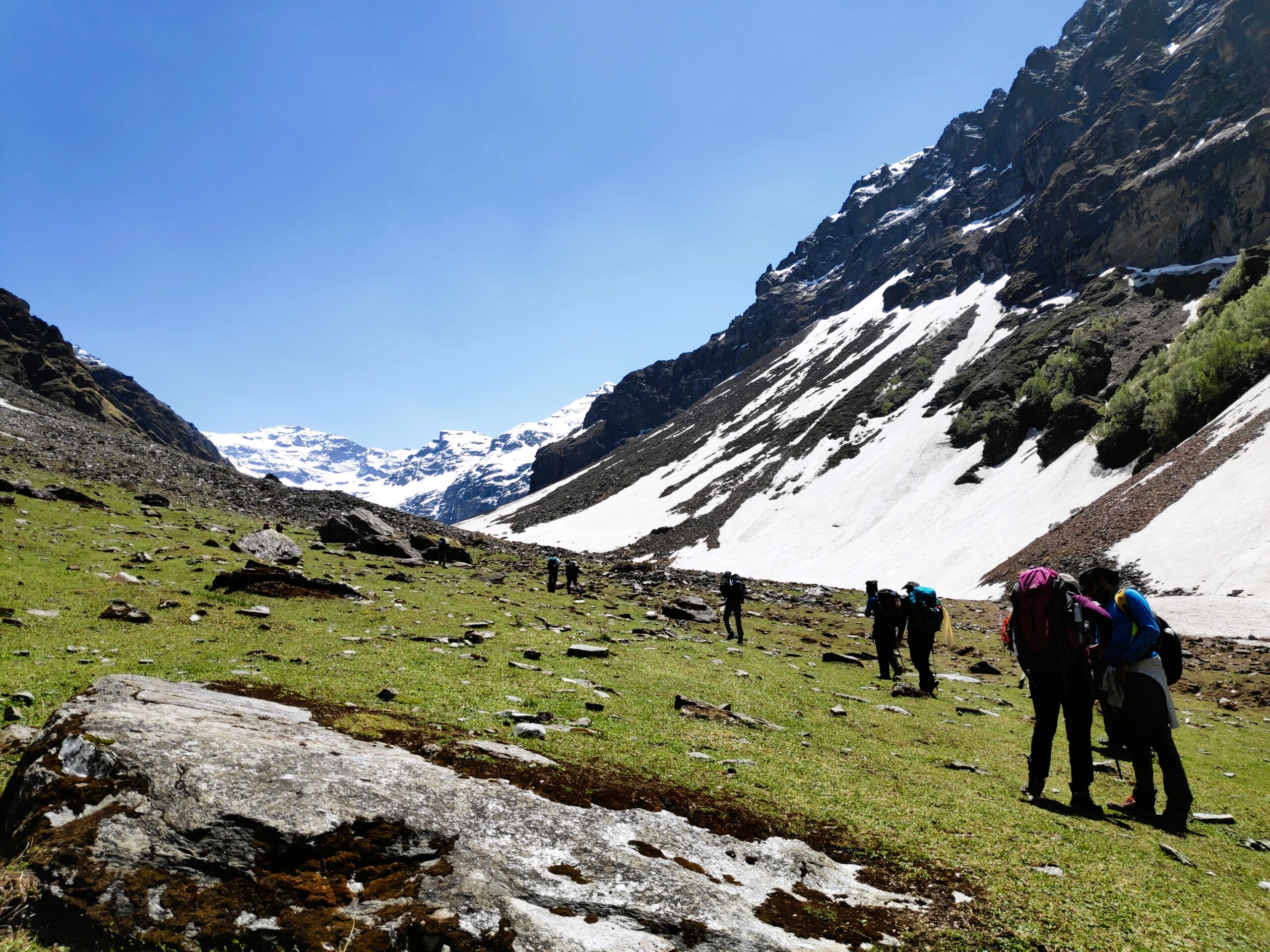
Day 7 - Upper Waterfall camp (3991 mts) to Rupin Pass (4686 mts) via Rati Pheri, further on to Ronti Gad (3991 mts)
Trek Time- 10 hours ; Trek Distance - 11 Kms
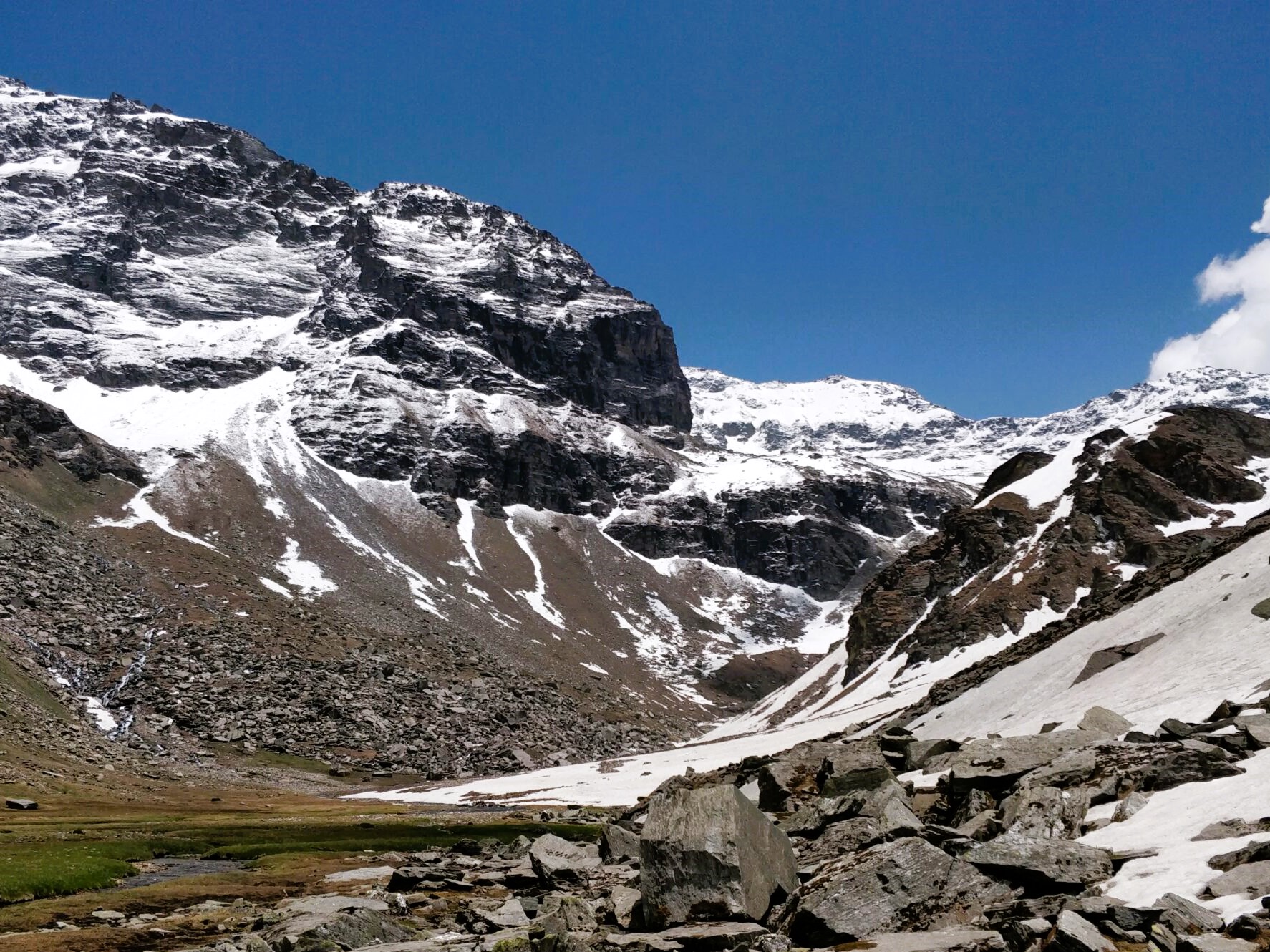
Day 8 - Ronti Gad (3991 mts) to Sangla (2620 mts) Via Sangla Kanda (3481 mts)
Trek Time-7 hours ; Trek Distance - 14 Kms
• Transportation from Shimla to Jiskun.
• All accommodation and food from Day 1 (Dinner) to Day 8 (Lunch)
• Rentals for all common gear provided to you like tent, sleeping bags etc.
• Forest entry permission charges.
• Guide and expertise charges.
• 5% GST
• Meals or drinks purchased by participants during the travel or trek (example biscuits, fruits etc)
• Rentals for personal gear (Refer things to get section)
• Trek Insurance (Optional)
• Flight/Train/Bus ticket till Shimla
• Backpack offloading charges. You are expected to carry your own backpack. Trekkers unable to do so can opt for a porterage service at 600/day.
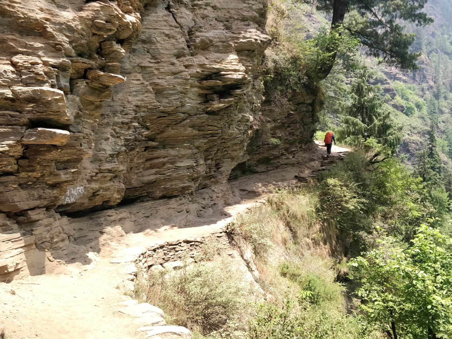


The first two days from Dhaula are very hot and not quite scenic. You walk on a concrete road (where vehicles pass) for major portions of it too! The first two days are very infamous for flies too. This degrades the experience.
A certified trek leader, a guide, cook & porters will accompany you during the trek
No. Guests are expected to carry their own power banks.
We’ve been organizing treks for over five years and have had many female trekkers trek with us. In fact, a lot of them come solo for treks. There has never been a complaint about the atmosphere of a trek, about other trekkers or our professionalism. They have all been kind enough to leave a review.
You will be sleeping in twos or threes in your tents in sleeping bags. The sleeping bags are snug and comfortable. We will be providing inflatable pillows.
Through the trek, there are no bathing facilities at campsites. Trekkers often take advantage of running streams to freshen themselves up.
In all the camps where the accommodation is in tea houses/ home stays, there will be proper toilets. The toilets are mostly western, in case if they‘re Indian, then we try to provide a toilet seat most of the times.
On the day of camping, we will have toilet tents (with a dry pit toilet), the most hygienic way of answering nature’s call.
A dry pit toilet is an eco-friendly sanitation solution featuring a pit dug into the ground, topped with a toilet seat and a wrought iron stand. Near the toilet, a pile of mud, sand, or coco peat is provided for covering waste after use, facilitating rapid breakdown of fecal matter due to increased microbial activity. This method eliminates the need for water, thereby preventing contamination of nearby water sources, as water toilets are prohibited at campsites.
While toilet paper is available, please use it sparingly to avoid overloading the pit, which can take years to decompose. Please refrain from using wet wipes as they are not bio degradable or use bio-degradable wipes.
Most wild animals are naturally wary of human activity and prefer to stay in more remote, quieter parts of their habitat. Here’s why wild animals typically do not approach camps.
Yes, you are ideally expected to carry your backpack. But you do have an option of offloading your bags on a mule for an additional cost. The cost will be INR 400/ per day per bag. One is expected to inform us about offloading 1 week prior to the trek.
Good Sturdy Backpack: Prefer a trekking pack over a backpacking one. The size of the backpack depends upon the participant. Normally for a 7-9 day trek a 50-60 litre pack should suffice.
Shoes: Any waterproof trek (not hike) shoe would be ideal.
Socks: 3 pair cottons and 3 pairs of woollens.
Trek pants (ideally water resistant): Get two quick dry summer trek pants. On summit climb or a major altitude gain day for Goechala, Rupin and Stok), you can replace one dry fit trek pant with Shell trekking pants. If you don’t have trek pants you can replace it with Gym track pants.
T-shirt/ Base layer: Get 3 T-shirts/ trekking base layer on the trek, one of which should be thick and full sleeve. Avoid cotton and prefer dry fit.
Fleece/ Sweater/ good quality Hoodie: Get 1 fleece jacket or sweater. Fleece is preferred over sweater or hoodie as it is lightweight and easy to carry. Sweaters and Jackets can be heavier than Fleece for the warmth they offer.
Down/ Padded Jacket – Down/ Padded jacket (Upto -5 degrees). If you don’t want to get a padded/ down jacket, get two fleeces.
Cotton track pants for camp – These are specifically for cold evenings at the campsite. This can be ignored if you are comfortable wearing your trekking pants in the camp.
Thermals: 1 pair. We wear thermals only upon reaching the campsite not while trekking.
Windproof Jacket: All rain proof can be used as Wind proofs. Required as an additional layer during trekking in windy conditions. Avoid if you have a rain proof jacket.
Rainwear:
Option A – Rain set – One Waterproof jacket (3000 mm waterproofing), Rain proof pants and Bag cover
Option two – Poncho that covers your body and bag completely.
We ideally recommend Option 1 as poncho makes trekking difficult.
Woolen Cap/ Balaclava-1: To cover your ears, head and neck. Get one woollen cap and one neck warmer or balaclava.
Neck Warmer/ Scarf-1: For evenings. Avoid if you are comfortable using a Balaclava.
Gloves: 2 gloves out of which 1 can be water proof and one woollen. The waterproof one has to ideally be padded and a size larger than you normally use. This is so that you can wear both your gloves together if required.
Suncap – 1
Sunglasses – 1
Toiletries – Also include sunscreen, moisturizer and lip-cream
Headlamp/Torch -1. Preferably headlamp.
2 water bottles (1 litre each) – One can be a thermos flask. One can also get a hydration pack.
Camp shoes/ Flip flops for camp
Plastic covers for inside the backpack to keep your clothes dry
Daypack – Required if you have a summit days climb. Preferably one that can be compressed.
Documents: 2 passport sized photograph, Address and Photo proof (Driving License or Aadhaar card), Doctor’s medical certificate saying that you are fit for the trek. We reserve the right to not take you on the trek if you fail to produce this.
Trekking pole
7-8 kms slow jog OR 25kms kms cycling. Pace is not important, consistency is important (non-stop jogging/running/cycling)
Squats 30 x 3, Lunges 30 x 3, Calf raises 30 x 3
All of the above at least 6 times a week
Climbing stairs 75 floors with backpack (Once a week, ideally after a run)
The common perception is that alcohol makes you feel warmer, however it also dehydrates you & dehydration can be fatal while trekking. Hence consumption of alcohol is prohibited. Smoking in camps is not allowed.
If you cancel –
– 60 days before the trip: we can process a complete refund minus minimum processing charges.
– Between 30-45 days before the trip: you will be refunded 50% of the trek fee.
– Within 30 days before the trek starts: No refund.
– If your spot is replaced in a full batch: we will process a complete refund after canceling minute operational charges. (For fixed departures only)